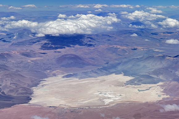
Aerial View of the Atacama Desert, Chile
As our flight approached Calama airport, we had a view to the east of the volcanic landscape, dotted with large salt pans, some encompassing saltwater lagoons. This is the central area of the Atacama Desert, the driest nonpolar desert in the world. Average rainfall has historically been 0.6" per year, with some locations receiving less than 0.1" per year. Zero rainfall recorded in a year is not unusual, even for multiple years in a row.
Over time, the sparse rainfall, and fog in some areas, deposits water that collects in natural basins and underground aquifers. The evaporation of surface water leaves mineral salts behind, observed as salt pans and saltwater lagoons.